

The Black Wallaby Loop Track is a relatively easy 2.6 kms loop walk within Googong Foreshores reserve and for me has the largest bang for buck, in terms of scenery, of all the walks in the reserve. This bang for buck can be increased if you vary the walk slightly to include a visit to the Googong Lookout and return via the tail end of the Bradleys Creek walk, rather than returning via the bitumen road, as outlined in the reserve’s brochure. Opting for this variation (covered in this post) will add 1.8 kms to the walk making it 4.4 kms, without increasing the walk’s difficulty rating. Allow at least 1.5 hrs for the extended walk.
The trail head for the walk is the Downstream Picnic Area car park, in the northern part of the Googong Foreshores reserve, itself about 32 kms or half an hours drive from Canberra city centre. This is a popular picnic area beside the Queanbeyan river and free bbq facilities, shaded eating areas and toilets are available. Note that the reserve is not a 24 hrs park and that the (northern) gates don’t open until 8.00am and are locked again at 6.00pm in non-daylight savings time and 8.00pm in daylight savings time.

Leaving the car park, via the signpost for the walk was located to the left of where I dove in (close to the covered bbq area), the initial part of the walk took me up a slight hill, across the park entry road and into the bush, along a well used and marked track.
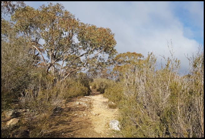
The early part of the walk is through an area of native shrubs and trees, with limited views. That said, I never cease to be amazed at the beauty and resilience of the Canberra region’s native vegetation, whether it be living or long dead, especially when one considers that temperatures here can vary from around -7 degrees centigrade to +45 degrees, or more ….. a range of over 50 degrees across the year. Add to this long periods of drought (years) and I am amazed that anything grows – though it does. Even a few millimetres of rain can bring about tremendous changes in the appearance of an area like this. As I did the walk, for the purposes of this post, mid-winter and during an extended period of little or no rain everything looks rather dry and the reservoir, when I got to see it, was at the lowest it has been for years, as were all the reservoirs supplying drinking water for Canberra, prompting talk of tightening water restrictions. Thankfully, since then we have had a significantly wetter spring than normal and reservoir levels are (Oct 2020) at levels they have not been at in years – one of the few positives I can think of in 2020!


After about 400 metres walking along the narrow, undulating, path the Queanbeyan River and its cascades comes into sight. Moving along the track I had constant views down onto the river and across to the lookouts on the very short Cascades walk. While there was nothing stopping me going down to the river there are no formed paths and some bush bashing would have been required. Why do this when I can easily access the river from the 200 metres long Cascades walk?


Not being tempted to exert myself more than necessary, I continued on along the path which, while there were a few sets of steps, remained relatively easy making for enjoyable walking.

Soon the path veered left and away from the river at which point the Googong Dam wall and slipway came into view.


Not far ahead the path lead me out into a more open area and afforded me spectacular views of the Googong Dam, the reservoir and beyond. A seat, to enjoy the view, would be a useful addition here though there was ample suitable short grass should I have wanted to linger a bit longer.


While, as noted above, access to the river (downstream from the Dam) is permitted, if not easy, do not be tempted to cross over to the Dam or go down to the water’s edge here, or at any point along this (northern and eastern) part of the reservoir. By way of deterrence there is a high fence and signs prohibiting access, to protect one of the main drinking water sources for nearby Queanbeyan and Canberra. Limited use access (boating and fishing but no swimming) to the reservoir is available along its western side.
Having enjoyed the views I continued along the track, now downhill and leading back towards the picnic area. Very soon, at the approach to a saddle dam, I reached some directional signage and now had a number of options.

If I wanted to return to the picnic area/ car park I could turn left and take the bitumen road and be back in ten to fifteen minutes. While not particularly interesting from a walk perspective this is the shortest way back and that anticipated in the 2.6 kms basic walk as detailed in the reserve’s literature.

As indicated earlier, and highly recommended (by me), I continued on across the saddle dam, headed for the Googong Lookout.
According to Wikipedia, a ‘saddle dam is an auxiliary dam constructed to confine the reservoir created by a primary dam either to permit a higher water elevation and storage or to limit the extent of a reservoir for increased efficiency’. In this case, though the water was nowhere near it (and I suspect it rarely is), it probably serves both purposes. In any event, crossing the dam I again had great views out towards the reservoir and to bushland on the other side.


Having crossed the dam I continued uphill a bit before veering off to my right, out along the ridge-line of a spur taking me to the Googong Lookout. As there are many points where you can veer off towards the lookout there isn’t really a single distinct path – if you reach the next set of signage you will have gone to far … return a few metres and veer left.
Heading up to the lookout –


And the view from the lookout.


From the lookout it was about 1.5 kms back to the end of the walk. Once I returned to the main path I turned right, in the direction of Bradleys Creek. After a few metres, at a sign for the car park or Bradleys Creek, I turned left into the bush and continued for a kilometre to the car park and the end of what was an excellent walk.

While I didn’t see any on today’s walk this, more open, section of the walk is where you are most likely to spot kangaroos (perhaps even a black wallaby!) and wombats.
My next Queanbeyan review– HERE
Return to the beginning of my Queanbeyan reviews – HERE

Enjoyed that very much. Some spectacular views and, in parts, the landscape looks fascinatingly alien – I guess this must be mainly due to the vegetation. That’s a heck of a temperature range!!
LikeLiked by 1 person
Thanks for looking in and commenting. Agree it is some temp difference…
LikeLiked by 1 person
Another lovely walk and some great views!
LikeLiked by 1 person